


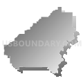
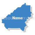
Shelby County PUMA, Alabama
About
Outline

Summary
| Unique Area Identifier | 192091 |
| Name | Shelby County PUMA |
| State | Alabama |
| Area (square miles) | 809.53 |
| Land Area (square miles) | 784.93 |
| Water Area (square miles) | 24.59 |
| % of Land Area | 96.96 |
| % of Water Area | 3.04 |
| Latitude of the Internal Point | 33.26293660 |
| Longtitude of the Internal Point | -86.67810420 |
Maps


Graphs
Select a template below for downloading or customizing gragh for Shelby County PUMA, Alabama


Neighbors
Neighoring Public Use Microdata Area (by Name) Neighboring Public Use Microdata Area on the Map
- Chilton, Tallapoosa, Chambers & Coosa Counties PUMA, AL
- Dallas, Bibb, Marengo, Hale, Sumter, Perry & Greene Counties PUMA, AL
- Jefferson County (Southeast)--Hoover (North), Vestavia Hills & Homewood Cities PUMA, AL
- Jefferson County (West)--Bessemer, Hueytown & Pleasant Grove Cities PUMA, AL
- St. Clair & Blount Counties PUMA, AL
- Talladega, Cherokee, Randolph, Cleburne & Clay Counties PUMA, AL
Top 10 Neighboring County (by Population) Neighboring County on the Map
- Jefferson County, AL (658,466)
- Shelby County, AL (195,085)
- St. Clair County, AL (83,593)
- Talladega County, AL (82,291)
- Chilton County, AL (43,643)
- Bibb County, AL (22,915)
- Coosa County, AL (11,539)
Top 10 Neighboring County Subdivision (by Population) Neighboring County Subdivision on the Map
- Birmingham CCD, Jefferson County, AL (455,278)
- Alabaster-Helena CCD, Shelby County, AL (118,831)
- Hoover CCD, Jefferson County, AL (45,938)
- Chelsea CCD, Shelby County, AL (35,970)
- Moody CCD, St. Clair County, AL (25,023)
- Pell City CCD, St. Clair County, AL (23,885)
- Greenwood CCD, Jefferson County, AL (22,289)
- Sylacauga CCD, Talladega County, AL (22,123)
- Leeds CCD, Jefferson County, AL (15,558)
- Jemison CCD, Chilton County, AL (14,242)
Top 10 Neighboring Place (by Population) Neighboring Place on the Map
- Birmingham city, AL (212,237)
- Hoover city, AL (81,619)
- Vestavia Hills city, AL (34,033)
- Alabaster city, AL (30,352)
- Pelham city, AL (21,352)
- Helena city, AL (16,793)
- Leeds city, AL (11,773)
- Calera city, AL (11,620)
- Chelsea city, AL (10,183)
- Meadowbrook CDP, AL (8,769)
Top 10 Neighboring Unified School District (by Population) Neighboring Unified School District on the Map
- Jefferson County School District, AL (230,679)
- Birmingham City School District, AL (212,237)
- Shelby County School District, AL (170,473)
- Hoover City School District, AL (81,093)
- St. Clair County School District, AL (53,540)
- Talladega County School District, AL (49,716)
- Chilton County School District, AL (43,643)
- Vestavia Hills City School District, AL (34,033)
- Pell City City School District, AL (27,712)
- Bibb County School District, AL (22,915)
Top 10 Neighboring State Legislative District Lower Chamber (by Population) Neighboring State Legislative District Lower Chamber on the Map
- State House District 41, AL (73,181)
- State House District 43, AL (56,056)
- State House District 50, AL (55,378)
- State House District 48, AL (54,047)
- State House District 49, AL (52,014)
- State House District 46, AL (50,398)
- State House District 15, AL (48,965)
- State House District 42, AL (48,338)
- State House District 47, AL (48,011)
- State House District 33, AL (43,809)
Top 10 Neighboring State Legislative District Upper Chamber (by Population) Neighboring State Legislative District Upper Chamber on the Map
- State Senate District 14, AL (168,669)
- State Senate District 15, AL (160,461)
- State Senate District 17, AL (157,178)
- State Senate District 16, AL (149,527)
- State Senate District 12, AL (142,431)
- State Senate District 11, AL (125,111)
Top 10 Neighboring 111th Congressional District (by Population) Neighboring 111th Congressional District on the Map
- Congressional District 6, AL (754,482)
- Congressional District 3, AL (681,298)
- Congressional District 7, AL (603,352)
Top 10 Neighboring Census Tract (by Population) Neighboring Census Tract on the Map
- Census Tract 142.03, Jefferson County, AL (12,502)
- Census Tract 142.04, Jefferson County, AL (9,787)
- Census Tract 604.02, Chilton County, AL (8,776)
- Census Tract 302.14, Shelby County, AL (7,114)
- Census Tract 303.03, Shelby County, AL (7,016)
- Census Tract 306.09, Shelby County, AL (6,941)
- Census Tract 306.05, Shelby County, AL (6,847)
- Census Tract 306.04, Shelby County, AL (6,821)
- Census Tract 305.01, Shelby County, AL (6,734)
- Census Tract 302.16, Shelby County, AL (6,429)
Top 10 Neighboring 5-Digit ZIP Code Tabulation Area (by Population) Neighboring 5-Digit ZIP Code Tabulation Area on the Map
- 35242, AL (49,545)
- 35216, AL (36,408)
- 35244, AL (32,390)
- 35007, AL (26,225)
- 35124, AL (23,020)
- 35022, AL (18,888)
- 35243, AL (17,328)
- 35080, AL (15,881)
- 35040, AL (14,965)
- 35094, AL (14,212)